
Drone photography in Coach Hill, Alberta
Coach Hill's streets ride a shoulder of high ground, and frames pointed north across the Bow Trail pathway pick up the river valley below — water the neighbourhood itself never sees from the kerb. Shot from the street, a Coach Hill listing is a hillside house with no context; the buyer never learns that the lot rides high enough to borrow the valley.
Does Fly4MEdia fly drones in Coach Hill?
Yes. Fly4MEdia flies drone photography and cinematography in Coach Hill, Alberta. The airspace is CYYC control zone edge. An Advanced RPAS certificate covers the flight, with airspace authorisation in place before the booking is confirmed. From the Calgary base, mobilisation is typically 15 minutes.
Coach Hill at a glance.
| Base of operations | Calgary, Alberta |
|---|---|
| Drive time from base | 15 minutes |
| Airspace | CYYC control zone edge |
| Nearest aerodrome | Calgary International Airport (CYYC) |
| Authorisation required | Yes — filed before booking is confirmed |
| Flight status | Flown with airspace authorisation |
| Certification | Transport Canada RPAS — Advanced Operations |
| Response | Reply within one business day |
| Airspace last verified | 2026-09-01 |
Flying Coach Hill: the ground truth.
Coach Hill's streets ride a shoulder of high ground, and frames pointed north across the Bow Trail pathway pick up the river valley below — water the neighbourhood itself never sees from the kerb. Shot from the street, a Coach Hill listing is a hillside house with no context; the buyer never learns that the lot rides high enough to borrow the valley.
An elevated hold above the property, composed north over the Bow Trail pathway, puts the water and the high ground into one frame — delivered in the standard turnaround.
Airspace. Coach Hill is about 14 km from Calgary International, near the CYYC control zone's charted boundary; a single address can fall either side of the line. The default plan treats it as controlled airspace until NAV Drone confirms otherwise, with authorisation filed before booking wherever it is required. The specific site and altitude are confirmed against NAV Drone before every flight. This is a corridor-level assessment; the specific address is confirmed against NAV Drone before every flight.
Terrain. A high shoulder of west Calgary that falls away northward toward the river valley; streets curve along the contour rather than running as a grid, so the lots step with the slope.
Wind. High ground in the chinook belt. Westerlies reach Coach Hill early and unbroken, and the slope adds mechanical turbulence on the lee side, so calm-morning windows are worth protecting.
Light. North-facing slopes hold snow and shadow longer than the flat grid below, which keeps winter frames graphic; in summer the late, low golden hour models the contour streets instead of flattening them.
On the ground. City of Calgary parks bylaws restrict drone launches and landings on municipal park and pathway land, so takeoff is staged from private property with the client's consent. About 15 minutes west of the base. Patterson, Signal Hill and Cougar Ridge are minutes away, so a Coach Hill booking pairs well into a west-side run on the same authorisation footing.
From the reel
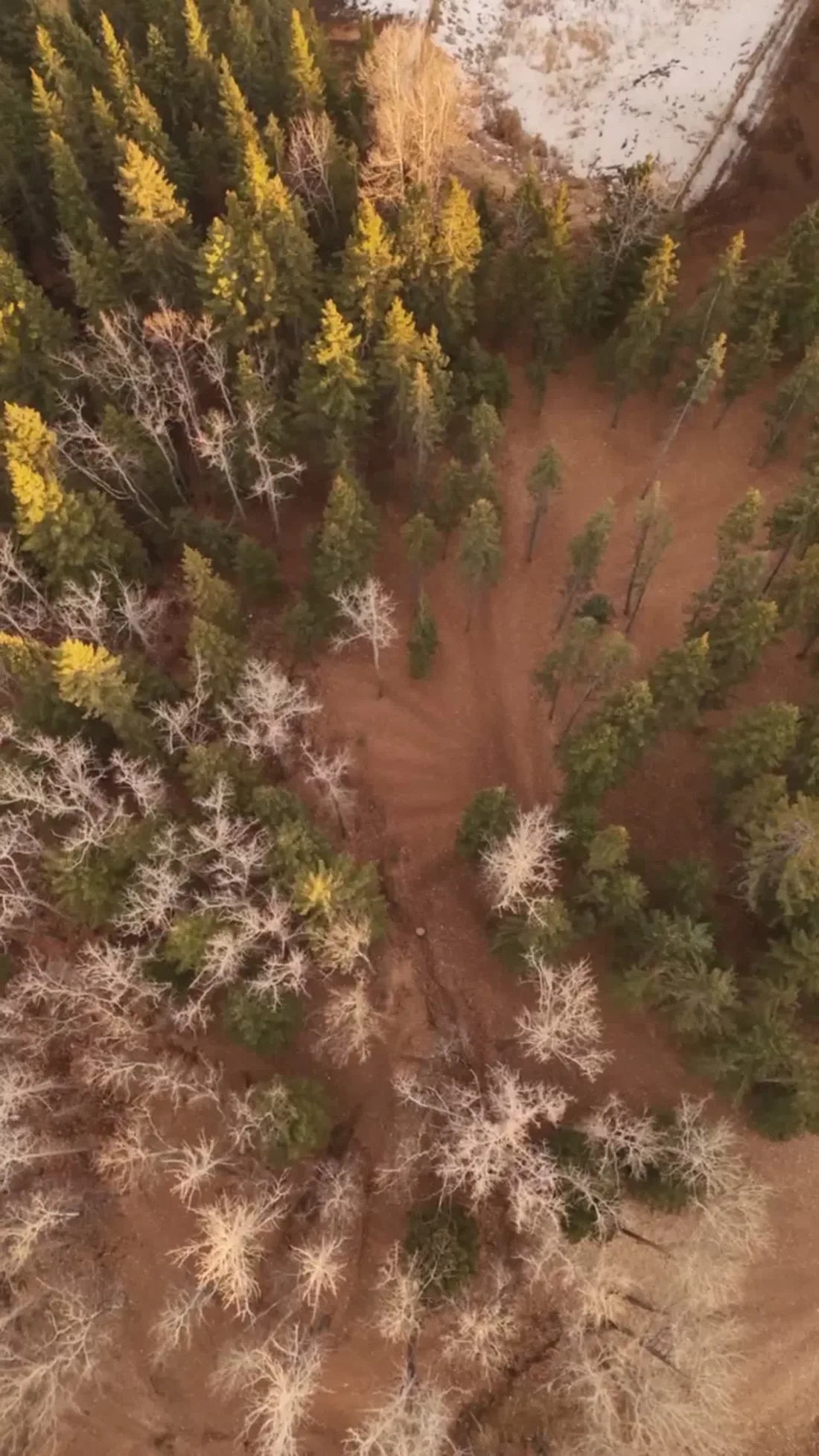
What gets shot in Coach Hill.
- luxury residential
- commercial retail
Every subject above is delivered through the same aerial photography and cinematography services, scoped and quoted before the shoot is booked.
What the research actually says.
403% more enquiries
Listings that include video have been reported to receive several times the enquiry volume of listings without it.
Enquiry volume is the top of the funnel. A listing that starts more conversations closes from a larger pool.
Reported by RubyHome, real estate photography research roundup, 2024
68% faster
Listings marketed with aerial photography have been reported to sell substantially faster than those using ground photography alone.
On a listing carrying monthly holding costs, the weeks removed from time-on-market are the return on the shoot.
Reported by RubyHome, real estate photography research roundup, 2024
USD 9.83 billion
Emergen Research sizes the global drone inspection and monitoring market at nearly ten billion dollars in 2025, growing at a 16.4% compound annual rate.
Aerial capture is a procured category with established vendors and comparable rates, not an experimental line item requiring internal justification.
Emergen Research, 2025
Coach Hill and what surrounds it.
- Aerial photography in Patterson1 km · CYYC control zone edge
- Aerial photography in Signal Hill2 km · Controlled — between CYYC and CYBW
- Aerial photography in Cougar Ridge3 km · CYYC control zone edge
- Aerial photography in Altadore6 km · CYYC control zone edge
- Aerial photography in Aspen Woods3 km · Controlled — between CYYC and CYBW
How a Coach Hill shoot runs.
- 01Scope and quote. Most Coach Hill work is luxury residential or commercial retail, and the shot list follows the subject. Mobilisation is stated separately from the fee.
- 02Airspace. Coach Hill sits under Calgary International Airport (CYYC), 14 km away. Authorisation is filed with NAV CANADA and the date is confirmed once it is in hand.
- 03Weather window. High ground in the chinook belt. Westerlies reach Coach Hill early and unbroken, and the slope adds mechanical turbulence on the lee side, so calm-morning windows are worth protecting. North-facing slopes hold snow and shadow longer than the flat grid below, which keeps winter frames graphic; in summer the late, low golden hour models the contour streets instead of flattening them.
- 04Shoot day. About 15 minutes from the Calgary base. Launch from the subject property with the owner's permission; city of Calgary parks bylaws restrict drone launches and landings on municipal park and pathway land, so takeoff is staged from private property with the client's consent.
- 05Delivery. Edited files delivered digitally — no attendance required at any stage, which is how out-of-province owners of Coach Hill property are served.
Coach Hill questions, answered.
Which control zone applies to drone flights in Coach Hill?
Coach Hill sits about 14 km from Calgary International, near the charted boundary of the CYYC control zone — close enough that the exact address decides the paperwork. Fly4MEdia plans it as controlled airspace until NAV Drone shows otherwise, and any required authorisation is filed before the shoot date is booked.
Can an aerial photo show the river valley from a Coach Hill property?
Often, yes. The community rides a shoulder of high ground, so an elevated frame composed north across the Bow Trail pathway can carry the valley in the background of a listing shot. Whether it works for a specific lot depends on position and legal altitude, both checked during planning.
Coach Hill is 1 km from Patterson.
Every quote starts at the Calgary base, which is why identical subjects in Coach Hill and Patterson — 1 km apart — price differently.
Nearby
Coverage
Airspace information last verified . Rules change — every flight is re-checked before it happens.