
Drone photography in Exshaw, Alberta
Exshaw is a working industrial hamlet — a cement plant and quarry operating directly beneath some of the most photographed mountain scenery in Alberta. That mix is the whole visual story here, and a frame that crops the industry out is selling a place that does not exist.
Does Fly4MEdia fly drones in Exshaw?
Yes. Fly4MEdia flies drone photography and cinematography in Exshaw, Alberta. The airspace is Class G uncontrolled. This airspace does not normally require an authorisation. From the Calgary base, mobilisation is typically 1.1 hours.
Exshaw at a glance.
| Base of operations | Calgary, Alberta |
|---|---|
| Drive time from base | 1.1 hours |
| Airspace | Class G uncontrolled |
| Nearest aerodrome | Canmore municipal heliport |
| Authorisation required | No |
| Flight status | Flown routinely |
| Certification | Transport Canada RPAS — Advanced Operations |
| Response | Reply within one business day |
| Airspace last verified | 2026-08-31 |
Flying Exshaw: the ground truth.
Exshaw is a working industrial hamlet — a cement plant and quarry operating directly beneath some of the most photographed mountain scenery in Alberta. That mix is the whole visual story here, and a frame that crops the industry out is selling a place that does not exist.
Industrial and landscape subjects are composed together deliberately, which is what makes Exshaw imagery useful for operations reporting as well as marketing.
Airspace. Exshaw sits in uncontrolled Class G airspace in the lower Bow Valley, outside the national park boundary. The park line to the west is plotted on every flight plan. This is a corridor-level assessment; the specific address is confirmed against NAV Drone before every flight.
Terrain. The lower Bow Valley floor, hemmed by steep front-range walls with the river running through and a large industrial footprint on the north side.
Wind. One of the windiest stretches of the Bow corridor — the valley narrows here and accelerates westerly flow markedly.
Light. The valley loses direct sun early against the south wall. Winter gives the cleanest contrast between snow, rock and industrial structure.
On the ground. M.D. of Bighorn land-use rules apply, and the Banff National Park prohibition begins a short distance west of the hamlet. About 65 minutes west of the Calgary base on the Trans-Canada. Scheduled against the valley wind, which is the binding constraint.
From the reel
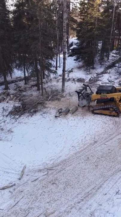
What gets shot in Exshaw.
- industrial yard
- municipal infrastructure
- tourism hospitality
Every subject above is delivered through the same aerial photography and cinematography services, scoped and quoted before the shoot is booked.
What the research actually says.
Up to 75% less time
McKinsey & Company reports that drones can cut surveying time by up to three quarters against traditional ground methods — a three-day site survey completed inside one.
On a consulting engagement billed by the day, survey duration is not a line item. It is the schedule.
Reported by McKinsey & Company, cited by Datumate, 2025
18 days to 4 hours
Marathon Pipe Line cut its response time to potential pipeline issues from eighteen days to four hours using drone inspection, preventing six major incidents in the first year at a reported saving of $8.3 million.
On linear infrastructure the cost is not the inspection. It is the time between a fault existing and anyone knowing about it.
Reported by Power Engineering, 2025
Industry standard
The National Association of Realtors maintains dedicated guidance on commercial drone use in listing marketing, including the certification and airspace rules an operator must meet.
Aerial media is an established part of listing marketing with real compliance requirements. The question is whether your operator meets them, not whether to use it.
Exshaw and what surrounds it.
- Aerial photography in Lac des Arcs3 km · Class G uncontrolled
- Aerial photography in Canmore13 km · Class G uncontrolled, adjacent to Banff National Park
- Aerial photography in Dead Man's Flats6 km · Class G uncontrolled
- Aerial photography in Harvie Heights17 km · Class G uncontrolled, immediately adjacent to Banff National Park
- Aerial photography in Morley25 km · Class G uncontrolled airspace over First Nation land
How an Exshaw shoot runs.
- 01Scope and quote. Most Exshaw work is industrial yard or municipal infrastructure, and the shot list follows the subject. Mobilisation is stated separately from the fee.
- 02Airspace. Checked against NAV Drone from the address, not the postcode. Exshaw is class g uncontrolled, so authorisation is not normally required — but Canmore municipal heliport is 17 km away and its circuit is plotted regardless.
- 03Weather window. One of the windiest stretches of the Bow corridor — the valley narrows here and accelerates westerly flow markedly. The valley loses direct sun early against the south wall. Winter gives the cleanest contrast between snow, rock and industrial structure.
- 04Shoot day. About 65 minutes from the Calgary base. Launch from the subject property with the owner's permission; m.D. of Bighorn land-use rules apply, and the Banff National Park prohibition begins a short distance west of the hamlet.
- 05Delivery. Edited files delivered digitally — no attendance required at any stage, which is how out-of-province owners of Exshaw property are served.
Exshaw questions, answered.
Can you fly a drone in Exshaw?
Yes. Exshaw sits in uncontrolled Class G airspace outside Banff National Park, so no NAV CANADA authorisation is normally required. The park boundary a short distance west is plotted on every flight plan before takeoff.
Why is Exshaw useful for industrial aerial documentation?
Because the site is large, active and hard to read from ground level. Stockpiles, haul routes and plant layout resolve into a single legible frame from altitude, which is what makes the imagery usable for operations reporting rather than only marketing.
Exshaw is 3 km from Lac des Arcs.
Because mobilisation is quoted from the Calgary base, Exshaw and Lac des Arcs, 3 km away, carry different quotes for an identical subject.
Nearby
Coverage
Airspace information last verified . Rules change — every flight is re-checked before it happens.