
Drone photography in West Hillhurst, Alberta
From altitude West Hillhurst's plan explains itself — the avenues run parallel to the Bow, Kensington Road NW carries the commerce along the southern blocks, and 19th Street NW stitches the grid down to the Bow River Pathway at the water. Listings here trade on that geometry — a block to the shops, a short walk to the pathway — and ground photography can assert it but never show it. The buyer is asked to take the map's word for the thing the pictures should prove.
Does Fly4MEdia fly drones in West Hillhurst?
Yes. Fly4MEdia flies drone photography and cinematography in West Hillhurst, Alberta. The airspace is Class C control zone (CYYC). An Advanced RPAS certificate covers the flight, with airspace authorisation in place before the booking is confirmed. Typical mobilisation from the Calgary base is 15 minutes.
West Hillhurst at a glance.
| Base of operations | Calgary, Alberta |
|---|---|
| Drive time from base | 15 minutes |
| Airspace | Class C control zone (CYYC) |
| Nearest aerodrome | Calgary International Airport (CYYC) |
| Authorisation required | Yes — filed before booking is confirmed |
| Flight status | Flown with airspace authorisation |
| Certification | Transport Canada RPAS — Advanced Operations |
| Response | Reply within one business day |
| Airspace last verified | 2026-09-01 |
Flying West Hillhurst: the ground truth.
From altitude West Hillhurst's plan explains itself — the avenues run parallel to the Bow, Kensington Road NW carries the commerce along the southern blocks, and 19th Street NW stitches the grid down to the Bow River Pathway at the water. Listings here trade on that geometry — a block to the shops, a short walk to the pathway — and ground photography can assert it but never show it. The buyer is asked to take the map's word for the thing the pictures should prove.
An approach run flown along the connecting street traces the actual route from the front door to the river in one continuous move, delivered in the standard turnaround.
Airspace. About 9 km from Calgary International, West Hillhurst falls inside the CYYC control zone as charted. An Advanced RPAS certificate covers the operation, with the NAV CANADA RPAS authorisation secured before the booking is confirmed. Flight plans here also keep clear of Foothills Medical Centre heliport, operating about 2 km away. The specific site and altitude are confirmed against NAV Drone before every flight. This is a corridor-level assessment; the specific address is confirmed against NAV Drone before every flight.
Terrain. Level river flat along the Bow, with the grid stepping gently uphill to the north and the open ground of Foothills Athletic Park and Helicopter Park breaking the rooflines.
Wind. Chinook belt. West wind arrives along the Bow corridor with little to slow it, and the open ground at Foothills Athletic Park gives an honest read of conditions before launch.
Light. The river flat greens early and holds it. Open water on the Bow gives reflected light at both ends of the day through most of the year, and the athletic fields read green well into fall.
On the ground. City of Calgary parks bylaws restrict drone launch and recovery in municipal parks and pathways — Helicopter Park included, despite the name — so flights are staged from private property with the client's consent. About 15 minutes from the Calgary base. Same-day is realistic once authorisation is filed, and a booking pairs naturally with Hillhurst, Parkdale or Capitol Hill.
From the reel
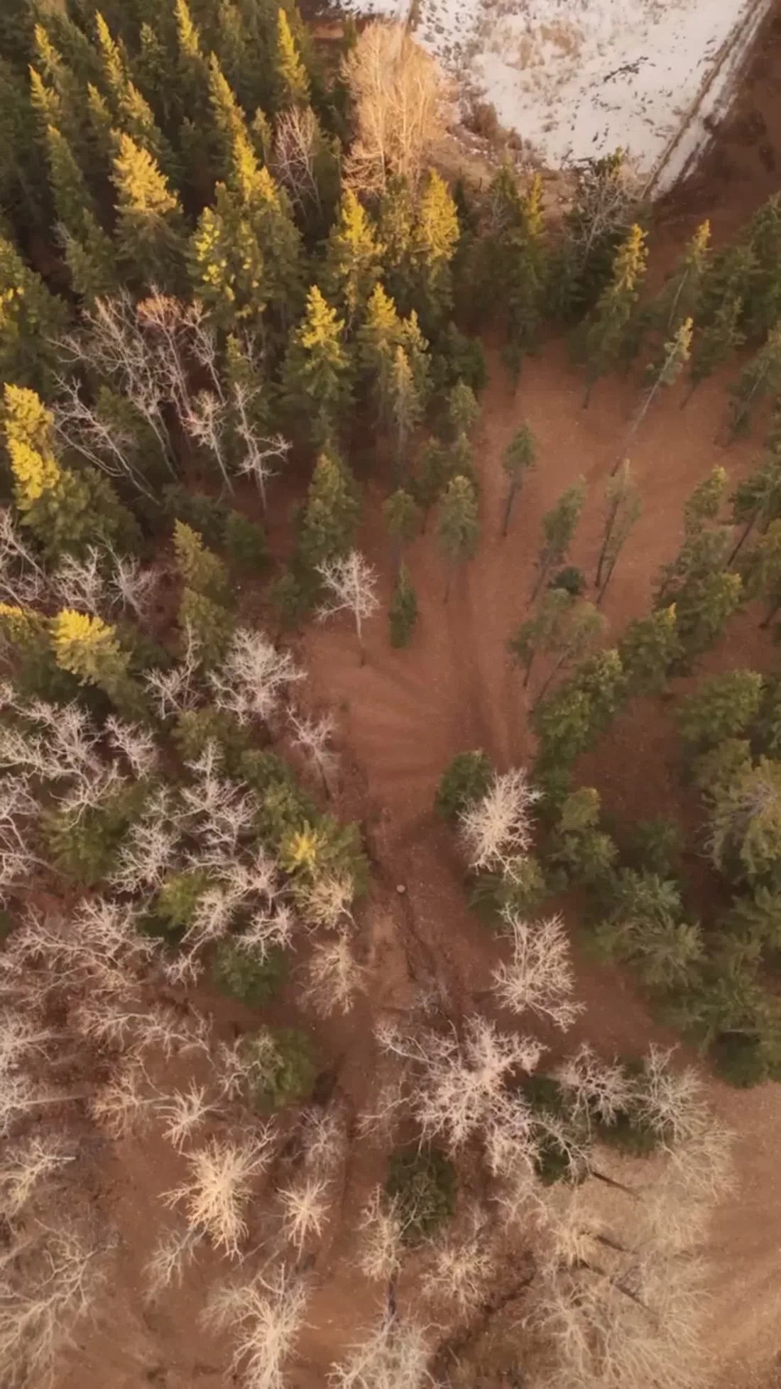
What gets shot in West Hillhurst.
- luxury residential
- construction progress
- commercial retail
Every subject above is delivered through the same aerial photography and cinematography services, scoped and quoted before the shoot is booked.
What the research actually says.
30% more
McKinsey research cited across the inspection sector finds that organisations relying on manual inspection spend materially more on maintenance and safety than those using drone-based assessment.
For a portfolio of assets, the inspection method is a recurring cost line, not a one-off purchase. The differential compounds annually.
Reported by McKinsey & Company, cited by Averroes, 2025
Industry standard
The National Association of Realtors maintains dedicated guidance on commercial drone use in listing marketing, including the certification and airspace rules an operator must meet.
Aerial media is an established part of listing marketing with real compliance requirements. The question is whether your operator meets them, not whether to use it.
Up to 90% lower
An Oklahoma pipeline operator reports remediation cost reductions of up to ninety per cent through early leak detection by drone.
Remediation cost scales with how long a problem ran undetected. Detection frequency is the variable, and aerial capture is what makes frequency affordable.
Reported by Power Engineering, 2025
West Hillhurst and what surrounds it.
- Aerial photography in Hillhurst1 km · Class C control zone (CYYC)
- Aerial photography in Parkdale1 km · Class C control zone (CYYC)
- Aerial photography in Capitol Hill2 km · Class C control zone (CYYC)
- Aerial photography in Calgary3 km · Class C control zone (CYYC)
- Aerial photography in Beltline3 km · Class C control zone (CYYC)
How a West Hillhurst shoot runs.
- 01Scope and quote. Most West Hillhurst work is luxury residential or construction progress, and the shot list follows the subject. Mobilisation is stated separately from the fee.
- 02Airspace. West Hillhurst sits under Calgary International Airport (CYYC), 9 km away. Authorisation is filed with NAV CANADA and the date is confirmed once it is in hand.
- 03Weather window. Chinook belt. West wind arrives along the Bow corridor with little to slow it, and the open ground at Foothills Athletic Park gives an honest read of conditions before launch. The river flat greens early and holds it. Open water on the Bow gives reflected light at both ends of the day through most of the year, and the athletic fields read green well into fall.
- 04Shoot day. About 15 minutes from the Calgary base. Launch from the subject property with the owner's permission; city of Calgary parks bylaws restrict drone launch and recovery in municipal parks and pathways — Helicopter Park included, despite the name — so flights are staged from private property with the client's consent.
- 05Delivery. Edited files delivered digitally — no attendance required at any stage, which is how out-of-province owners of West Hillhurst property are served.
West Hillhurst questions, answered.
Can drones operate in West Hillhurst with the Foothills heliport so close?
Yes, with planning. The Foothills Medical Centre heliport operates about 2 km away, so flight plans keep clear of its approaches, and West Hillhurst itself sits inside the CYYC control zone — flights run under an Advanced RPAS certificate with NAV CANADA authorisation filed before the date is confirmed.
Can an aerial actually show how close a West Hillhurst home is to the river?
Yes — that is the point of flying here. A single frame can hold the property, the run of avenues and the Bow River Pathway, and a short video traces the walk itself. Distance claims stop being copy and become something the buyer has watched.
Is Helicopter Park a place you can launch a drone from?
No — the name belongs to a neighbourhood park, not an aerodrome. City of Calgary bylaws restrict takeoff and landing in municipal parks, Helicopter Park included, so launches stage from private property with the client's consent. The park can still appear in frames; it just is not the launch site.
West Hillhurst is 1 km from Hillhurst.
Every quote starts at the Calgary base, which is why identical subjects in West Hillhurst and Hillhurst — 1 km apart — price differently.
Nearby
Coverage
Airspace information last verified . Rules change — every flight is re-checked before it happens.