
Drone photography in Church Ranches, Alberta
Church Ranches is drawn around its water: from the air, Church Ranches Lake is the organising feature, and the acreages read as parcels arranged to face shoreline rather than street. Water frontage is the value here and the one thing ground photography cannot measure. At eye level the lake reads as a sliver behind the trees, so the listing ends up selling the house and omitting the reason for its price.
Does Fly4MEdia fly drones in Church Ranches?
Yes. Fly4MEdia flies drone photography and cinematography in Church Ranches, Alberta. The airspace is Class C control zone (CYBW). Flights are conducted under an Advanced RPAS certificate with airspace authorisation filed before the shoot is confirmed. From the Calgary base, mobilisation is typically 25 minutes.
Church Ranches at a glance.
| Base of operations | Calgary, Alberta |
|---|---|
| Drive time from base | 25 minutes |
| Airspace | Class C control zone (CYBW) |
| Nearest aerodrome | Springbank Airport (CYBW) |
| Authorisation required | Yes — filed before booking is confirmed |
| Flight status | Flown with airspace authorisation |
| Certification | Transport Canada RPAS — Advanced Operations |
| Response | Reply within one business day |
| Airspace last verified | 2026-09-01 |
Flying Church Ranches: the ground truth.
Church Ranches is drawn around its water: from the air, Church Ranches Lake is the organising feature, and the acreages read as parcels arranged to face shoreline rather than street. Water frontage is the value here and the one thing ground photography cannot measure. At eye level the lake reads as a sliver behind the trees, so the listing ends up selling the house and omitting the reason for its price.
A boundary-line orbit flown around the parcel keeps the shoreline in frame the whole way, showing exactly how the property meets the water — delivered in the standard turnaround.
Airspace. Church Ranches sits about 5 km from Springbank Airport, inside the CYBW control zone as charted. Flights here are conducted under an Advanced RPAS certificate with a NAV CANADA RPAS authorisation obtained before the shoot is confirmed. Every flight is preceded by a NAV Drone check of the specific site and altitude. This is a corridor-level assessment; the specific address is confirmed against NAV Drone before every flight.
Terrain. Rolling, well-treed acreage country where large parcels wrap around open water; pasture and paddocks run out toward Range Road 33, and from altitude the community reads as countryside that happens to hold estates.
Wind. Open chinook-belt upland. West wind arrives with little between the foothills and these parcels to slow it, and on marginal days the lake surface is the most honest wind gauge on site.
Light. The open-water months carry the strongest frames — between ice-off and freeze-up the lake doubles a calm evening in reflection. After freeze-up the water reads as a white field, and the shot list shifts to treelines and parcel boundaries.
On the ground. Rocky View County's rules govern takeoff and landing on municipal land, so launches are staged from the subject property with the owner's permission. About 25 minutes from the Calgary base. The CYBW authorisation is filed as part of booking, and a Church Ranches visit pairs naturally with Bearspaw, Watermark or Silverhorn on a single mobilisation.
From the reel
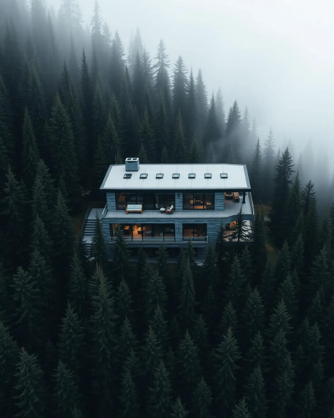
What gets shot in Church Ranches.
- acreage estate
- luxury residential
- agricultural
Every subject above is delivered through the same aerial photography and cinematography services, scoped and quoted before the shoot is booked.
What the research actually says.
18 days to 4 hours
Marathon Pipe Line cut its response time to potential pipeline issues from eighteen days to four hours using drone inspection, preventing six major incidents in the first year at a reported saving of $8.3 million.
On linear infrastructure the cost is not the inspection. It is the time between a fault existing and anyone knowing about it.
Reported by Power Engineering, 2025
Up to 75% less time
McKinsey & Company reports that drones can cut surveying time by up to three quarters against traditional ground methods — a three-day site survey completed inside one.
On a consulting engagement billed by the day, survey duration is not a line item. It is the schedule.
Reported by McKinsey & Company, cited by Datumate, 2025
91% less analysis time
Colonial Pipeline reports its drone analytics programme reduced inspection analysis time by 91%, prevented fourteen significant incidents annually and saved $4.2 million in emergency response costs.
Capture is the cheap half. The expensive half is turning imagery into a decision, and that is where the reduction lands.
Reported by Power Engineering, 2025
Church Ranches and what surrounds it.
- Aerial photography in Bearspaw3 km · Mixed — CYBW control zone boundary
- Aerial photography in Watermark at Bearspaw3 km · CYYC control zone edge
- Aerial photography in Silverhorn2 km · CYYC control zone edge
- Aerial photography in Cochrane12 km · Class G uncontrolled
- Aerial photography in Tuscany5 km · CYYC control zone edge
How a Church Ranches shoot runs.
- 01Scope and quote. Most Church Ranches work is acreage estate or luxury residential, and the shot list follows the subject. Mobilisation is stated separately from the fee.
- 02Airspace. Church Ranches sits under Springbank Airport (CYBW), 5 km away. Authorisation is filed with NAV CANADA and the date is confirmed once it is in hand.
- 03Weather window. Open chinook-belt upland. West wind arrives with little between the foothills and these parcels to slow it, and on marginal days the lake surface is the most honest wind gauge on site. The open-water months carry the strongest frames — between ice-off and freeze-up the lake doubles a calm evening in reflection. After freeze-up the water reads as a white field, and the shot list shifts to treelines and parcel boundaries.
- 04Shoot day. About 25 minutes from the Calgary base. Launch from the subject property with the owner's permission; rocky View County's rules govern takeoff and landing on municipal land, so launches are staged from the subject property with the owner's permission.
- 05Delivery. Edited files delivered digitally — no attendance required at any stage, which is how out-of-province owners of Church Ranches property are served.
Church Ranches questions, answered.
Do drone flights at Church Ranches need airspace authorisation?
Yes. Church Ranches sits about 5 km from Springbank Airport, inside the CYBW control zone as charted. Flights are conducted under an Advanced RPAS certificate with a NAV CANADA authorisation obtained before the shoot date is confirmed, and the exact site and altitude are checked against NAV Drone before every flight.
How do you photograph a lakefront parcel at Church Ranches?
From altitude, with the shoreline as the organising line. A slow orbit flown along the parcel boundary shows how much frontage the property actually commands on Church Ranches Lake, where the house sits relative to the water, and how the treed edges frame it — none of which survives a ground-level photograph.
When is the best light for a Church Ranches shoot?
Calm light beats dramatic light here. The lake is the frame's anchor, and a glassy surface at golden hour doubles the property in reflection. Wind is typically lightest early in the day before daytime heating builds, so morning holds are scheduled when a mirror-flat lake matters to the shot list.
Church Ranches is 3 km from Bearspaw.
Because mobilisation is quoted from the Calgary base, Church Ranches and Bearspaw, 3 km away, carry different quotes for an identical subject.
Nearby
Coverage
Airspace information last verified . Rules change — every flight is re-checked before it happens.