
Drone photography in Dalemead, Alberta
The country around Dalemead is close to level, and Dalemead Lake barely interrupts it — the water sits almost flush with the surrounding prairie, so the horizon runs unbroken in every direction from the hamlet. Flat land gives a ground-level camera nothing to work with. Every frame puts the horizon at mid-height, and a property's extent, its position against Highway 22X and its distance to the water all vanish into one thin band of foreground.
Does Fly4MEdia fly drones in Dalemead?
Yes. Fly4MEdia flies drone photography and cinematography in Dalemead, Alberta. The airspace is Class G uncontrolled. This airspace does not normally require an authorisation. Typical mobilisation from the Calgary base is 35 minutes.
Dalemead at a glance.
| Base of operations | Calgary, Alberta |
|---|---|
| Drive time from base | 35 minutes |
| Airspace | Class G uncontrolled |
| Nearest aerodrome | Strathmore aerodrome |
| Authorisation required | No |
| Flight status | Flown routinely |
| Certification | Transport Canada RPAS — Advanced Operations |
| Response | Reply within one business day |
| Airspace last verified | 2026-09-01 |
Flying Dalemead: the ground truth.
The country around Dalemead is close to level, and Dalemead Lake barely interrupts it — the water sits almost flush with the surrounding prairie, so the horizon runs unbroken in every direction from the hamlet. Flat land gives a ground-level camera nothing to work with. Every frame puts the horizon at mid-height, and a property's extent, its position against Highway 22X and its distance to the water all vanish into one thin band of foreground.
Altitude replaces the missing relief. A top-down series or a boundary-line orbit turns level ground into a legible plan — the parcel, the road and the lake edge in one frame — delivered in the standard turnaround.
Airspace. In uncontrolled Class G airspace about 9 km from Strathmore aerodrome, Dalemead lies outside the charted Calgary-area control zones, and no authorisation is normally required. The specific site and altitude are confirmed against NAV Drone before every flight. This is a corridor-level assessment; the specific address is confirmed against NAV Drone before every flight.
Terrain. Near-level prairie cropland broken only by Dalemead Lake, whose water sits nearly flush with the surrounding fields; the horizon runs unbroken past Highway 22X in every direction.
Wind. Squarely in the chinook belt, with open ground on every side. West wind arrives at Dalemead with a long unbroken run, so calm conditions are a scheduling decision rather than an assumption.
Light. The lake sets the calendar. Between ice-off and freeze-up, open water gives the level prairie its one strong contrast; after freeze-up the frame simplifies to field pattern, and harvest lays the strongest texture across it.
On the ground. Municipal land in Rocky View County carries the county's own park and public-land rules, so launch and landing default to the subject property with the owner's consent. About 35 minutes from the Calgary base with no authorisation lead time, so a Dalemead booking moves at the speed of the weather. Langdon and Indus sit close by, and grouping them on one trip east is the efficient way to work this corridor.
From the reel
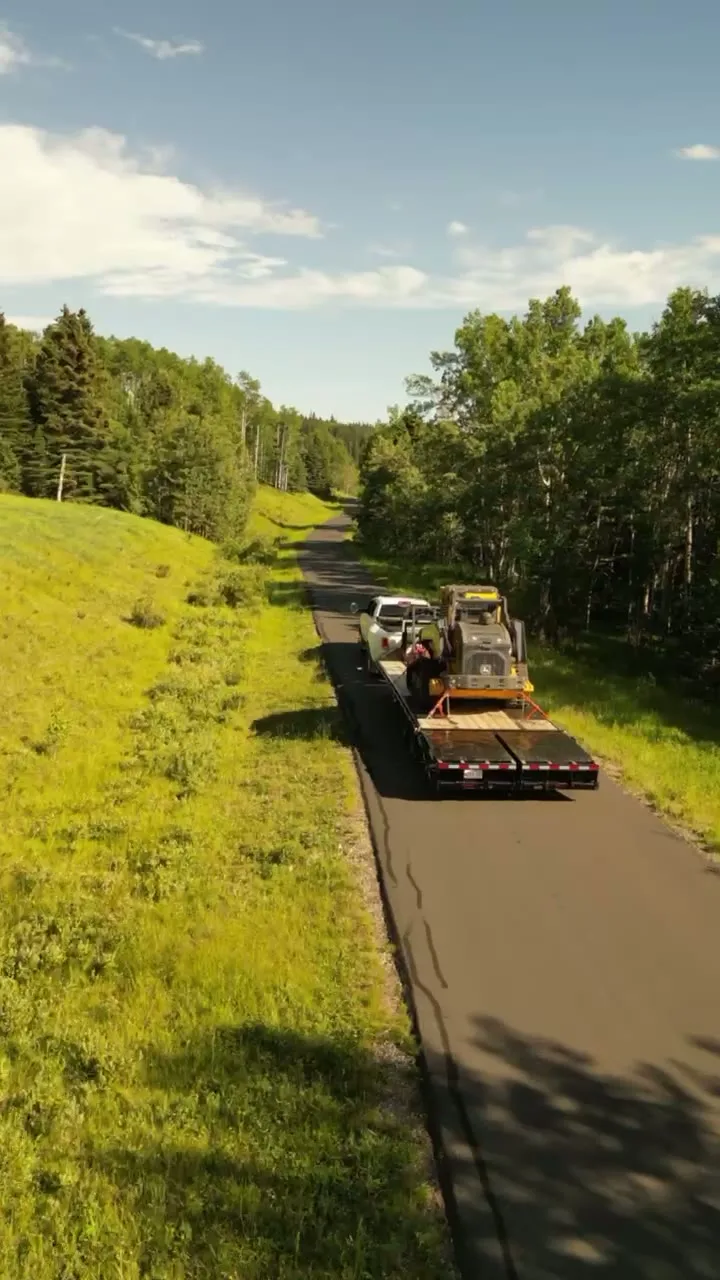
What gets shot in Dalemead.
- agricultural
- municipal infrastructure
Every subject above is delivered through the same aerial photography and cinematography services, scoped and quoted before the shoot is booked.
What the research actually says.
30% more
McKinsey research cited across the inspection sector finds that organisations relying on manual inspection spend materially more on maintenance and safety than those using drone-based assessment.
For a portfolio of assets, the inspection method is a recurring cost line, not a one-off purchase. The differential compounds annually.
Reported by McKinsey & Company, cited by Averroes, 2025
8 weeks, not 8 months
During post-hurricane restoration in Puerto Rico a drone team pulled 72,000 feet of conductor rope in eight weeks — work previously estimated at six to eight months.
In restoration and outage work the schedule is the cost. Aerial methods change the order of magnitude, not the margin.
Reported by Power Engineering, 2025
91% less analysis time
Colonial Pipeline reports its drone analytics programme reduced inspection analysis time by 91%, prevented fourteen significant incidents annually and saved $4.2 million in emergency response costs.
Capture is the cheap half. The expensive half is turning imagery into a decision, and that is where the reduction lands.
Reported by Power Engineering, 2025
Dalemead and what surrounds it.
- Aerial photography in Langdon6 km · Class G uncontrolled
- Aerial photography in Indus11 km · Class G uncontrolled, local aerodrome nearby
- Aerial photography in Standard44 km · Class G uncontrolled
- Aerial photography in Conrich24 km · CYYC control zone vicinity
- Aerial photography in Balzac40 km · Class C control zone (CYYC)
How a Dalemead shoot runs.
- 01Scope and quote. Most Dalemead work is agricultural or municipal infrastructure, and the shot list follows the subject. Mobilisation is stated separately from the fee.
- 02Airspace. Checked against NAV Drone from the address, not the postcode. Dalemead is class g uncontrolled, so authorisation is not normally required — but Strathmore aerodrome is 9 km away and its circuit is plotted regardless.
- 03Weather window. Squarely in the chinook belt, with open ground on every side. West wind arrives at Dalemead with a long unbroken run, so calm conditions are a scheduling decision rather than an assumption. The lake sets the calendar. Between ice-off and freeze-up, open water gives the level prairie its one strong contrast; after freeze-up the frame simplifies to field pattern, and harvest lays the strongest texture across it.
- 04Shoot day. About 35 minutes from the Calgary base. Launch from the subject property with the owner's permission; municipal land in Rocky View County carries the county's own park and public-land rules, so launch and landing default to the subject property with the owner's consent.
- 05Delivery. Edited files delivered digitally — no attendance required at any stage, which is how out-of-province owners of Dalemead property are served.
Dalemead questions, answered.
Do you need NAV CANADA authorisation to fly a drone at Dalemead?
Normally no. Dalemead lies outside the charted Calgary-area control zones in uncontrolled Class G airspace, about 9 km from Strathmore aerodrome, so no airspace authorisation is usually required. The specific site and altitude are still confirmed against NAV Drone before every flight, which is the standard final check.
What does Dalemead's flat terrain mean for aerial photography?
It means altitude does the work that relief cannot. From the ground every view is a thin band under a large sky; from above, a parcel becomes a plan — its boundaries, its access from Highway 22X and its position against Dalemead Lake all read in a single frame.
How quickly can a Dalemead shoot be scheduled?
Quickly, in most cases. Dalemead is about 35 minutes from the Calgary base in airspace with no authorisation lead time, so the schedule moves at the speed of the weather. It also pairs naturally with Langdon or Indus on a single trip east, which suits multi-property days.
Dalemead is 6 km from Langdon.
Every quote starts at the Calgary base, which is why identical subjects in Dalemead and Langdon — 6 km apart — price differently.
Nearby
Coverage
Airspace information last verified . Rules change — every flight is re-checked before it happens.