
Drone photography in Standard, Alberta
Standard is a railway plat and still reads as one from altitude: Railway Avenue sets the village's long axis, Centre Street crosses it, and the whole grid resolves in a few blocks before the fields take over. At ground level that compactness works against a client. A photograph of a business on Centre Street looks like a storefront anywhere, and the fact a buyer or visitor actually needs — where the village sits in its working landscape — never makes the frame.
Does Fly4MEdia fly drones in Standard?
Yes. Fly4MEdia flies drone photography and cinematography in Standard, Alberta. The airspace is Class G uncontrolled. Authorisation is not normally required in this airspace. Typical mobilisation from the Calgary base is 1.1 hours.
Standard at a glance.
| Base of operations | Calgary, Alberta |
|---|---|
| Drive time from base | 1.1 hours |
| Airspace | Class G uncontrolled |
| Nearest aerodrome | Beiseker aerodrome |
| Authorisation required | No |
| Flight status | Flown routinely |
| Certification | Transport Canada RPAS — Advanced Operations |
| Response | Reply within one business day |
| Airspace last verified | 2026-09-01 |
Flying Standard: the ground truth.
Standard is a railway plat and still reads as one from altitude: Railway Avenue sets the village's long axis, Centre Street crosses it, and the whole grid resolves in a few blocks before the fields take over. At ground level that compactness works against a client. A photograph of a business on Centre Street looks like a storefront anywhere, and the fact a buyer or visitor actually needs — where the village sits in its working landscape — never makes the frame.
An approach run flown down the grid's long axis carries the viewer from open field into the village core in one move, placing the property inside the whole community — delivered in the standard turnaround.
Airspace. Standard sits in uncontrolled Class G airspace, clear of the charted Calgary-area control zones and about 37 km from Beiseker aerodrome. Authorisation is not normally required here. Before any flight, the exact site and altitude are checked against NAV Drone. This is a corridor-level assessment; the specific address is confirmed against NAV Drone before every flight.
Terrain. Level grain country with the village set against it as a tight rectangular grid. From above, the streets end cleanly at field edge and the section lines carry on in every direction.
Wind. Open chinook-belt prairie. What the forecast calls a moderate west wind reaches Standard unbroken, so marginal days are judged on gust spread at the site rather than on the regional average.
Light. Long light suits the grid: early and late sun rakes down Railway Avenue and gives the rooflines shadow and depth that vanish by mid-morning. Seeding and harvest bookend the strongest aerial months, when machinery and swath lines animate the fields around the village.
On the ground. Village of Standard rules govern takeoff and landing on municipal land such as parks and road allowances, so launches are staged from private property with the owner's permission. About 65 minutes from the Calgary base — close enough that a same-day booking is realistic in a stable window. Standard pairs naturally with Rosebud, Hussar or Strathmore on a single mobilisation.
From the reel
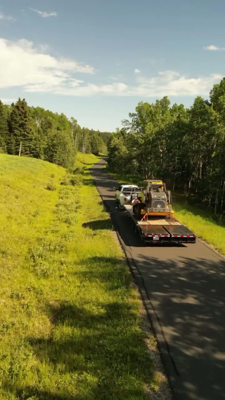
What gets shot in Standard.
- agricultural
- municipal infrastructure
- industrial yard
Every subject above is delivered through the same aerial photography and cinematography services, scoped and quoted before the shoot is booked.
What the research actually says.
Up to 90% lower
An Oklahoma pipeline operator reports remediation cost reductions of up to ninety per cent through early leak detection by drone.
Remediation cost scales with how long a problem ran undetected. Detection frequency is the variable, and aerial capture is what makes frequency affordable.
Reported by Power Engineering, 2025
91% less analysis time
Colonial Pipeline reports its drone analytics programme reduced inspection analysis time by 91%, prevented fourteen significant incidents annually and saved $4.2 million in emergency response costs.
Capture is the cheap half. The expensive half is turning imagery into a decision, and that is where the reduction lands.
Reported by Power Engineering, 2025
18 days to 4 hours
Marathon Pipe Line cut its response time to potential pipeline issues from eighteen days to four hours using drone inspection, preventing six major incidents in the first year at a reported saving of $8.3 million.
On linear infrastructure the cost is not the inspection. It is the time between a fault existing and anyone knowing about it.
Reported by Power Engineering, 2025
Standard and what surrounds it.
- Aerial photography in Strathmore26 km · Class G uncontrolled
- Aerial photography in Hussar29 km · Class G uncontrolled
- Aerial photography in Rosebud13 km · Class G uncontrolled
- Aerial photography in Kathyrn31 km · Class G uncontrolled
- Aerial photography in Keoma38 km · Class G uncontrolled
How a Standard shoot runs.
- 01Scope and quote. Most Standard work is agricultural or municipal infrastructure, and the shot list follows the subject. Mobilisation is stated separately from the fee.
- 02Airspace. Checked against NAV Drone from the address, not the postcode. Standard is class g uncontrolled, so authorisation is not normally required — but Beiseker aerodrome is 37 km away and its circuit is plotted regardless.
- 03Weather window. Open chinook-belt prairie. What the forecast calls a moderate west wind reaches Standard unbroken, so marginal days are judged on gust spread at the site rather than on the regional average. Long light suits the grid: early and late sun rakes down Railway Avenue and gives the rooflines shadow and depth that vanish by mid-morning. Seeding and harvest bookend the strongest aerial months, when machinery and swath lines animate the fields around the village.
- 04Shoot day. About 65 minutes from the Calgary base. Launch from the subject property with the owner's permission; village of Standard rules govern takeoff and landing on municipal land such as parks and road allowances, so launches are staged from private property with the owner's permission.
- 05Delivery. Edited files delivered digitally — no attendance required at any stage, which is how out-of-province owners of Standard property are served.
Standard questions, answered.
Is airspace authorisation needed for drone work in Standard?
No, not normally. Standard sits in uncontrolled Class G airspace, clear of the charted Calgary-area control zones and roughly 37 km from Beiseker aerodrome. Flights here are routine under the RPAS rules, and the specific site and altitude are still verified against NAV Drone before every flight.
What does aerial photography show in a village the size of Standard?
Context that street photography cannot reach. One frame from altitude holds the whole village — the grid off Railway Avenue, the ball diamonds at its edge, and the farmland that starts where the streets stop. For a business or yard here, that single frame explains location better than any map.
How far is Standard from your Calgary base?
About 65 minutes by road. A same-day booking is realistic when the forecast holds, and a Standard visit pairs naturally with Rosebud, Hussar or Strathmore on the same trip, so neighbouring clients can split one mobilisation across two or three shoots.
Standard is 26 km from Strathmore.
Mobilisation is quoted from the Calgary base, so a shoot in Standard and one 26 km away in Strathmore are priced differently even when the subject is identical.
Nearby
Coverage
Airspace information last verified . Rules change — every flight is re-checked before it happens.