
Drone photography in Hussar, Alberta
Hussar's light works in the horizontal. The country here is level enough that the last hour of sun travels across it rather than down onto it, and the Hussar Grain Elevator casts the longest shadow in the district. Shot at midday, the same country flattens into one unbroken tone — a farmyard, a machinery yard or the elevator itself photographs as beige on beige, and the client pays for a frame with no depth in it.
Does Fly4MEdia fly drones in Hussar?
Yes. Fly4MEdia flies drone photography and cinematography in Hussar, Alberta. The airspace is Class G uncontrolled. This airspace does not normally require an authorisation. From the Calgary base, mobilisation is typically 1.4 hours.
Hussar at a glance.
| Base of operations | Calgary, Alberta |
|---|---|
| Drive time from base | 1.4 hours |
| Airspace | Class G uncontrolled |
| Nearest aerodrome | Beiseker aerodrome |
| Authorisation required | No |
| Flight status | Flown routinely |
| Certification | Transport Canada RPAS — Advanced Operations |
| Response | Reply within one business day |
| Airspace last verified | 2026-09-01 |
Flying Hussar: the ground truth.
Hussar's light works in the horizontal. The country here is level enough that the last hour of sun travels across it rather than down onto it, and the Hussar Grain Elevator casts the longest shadow in the district. Shot at midday, the same country flattens into one unbroken tone — a farmyard, a machinery yard or the elevator itself photographs as beige on beige, and the client pays for a frame with no depth in it.
Hussar shoots are scheduled into the low-sun windows: a golden-hour hold at altitude lets the raking light pull texture out of the fields and separation out of every building, delivered in the standard turnaround.
Airspace. In uncontrolled Class G airspace about 64 km from Beiseker aerodrome, Hussar lies outside the charted Calgary-area control zones, and no authorisation is normally required. Before any flight, the exact site and altitude are checked against NAV Drone. This is a corridor-level assessment; the specific address is confirmed against NAV Drone before every flight.
Terrain. Open grain country on the level east side of Wheatland County. Sections of crop run to the horizon in every direction, and the village occupies a few compact blocks along Main Street with the elevator marking it from miles out.
Wind. The eastern reach of the chinook belt. West wind arrives over open sections with nothing between the foothills and Hussar to slow it, so gust spread rather than average speed is the flight-planning number here.
Light. Harvest is the aerial calendar's peak — late-summer swathing and combining draw lines across the sections that exist at no other time of year. Snow simplifies the same fields to graphic black and white, and low golden-hour light does the most work in both seasons.
On the ground. Village and Wheatland County rules govern takeoff and landing on municipal land, so launches are staged from private property with the owner's permission as the default. About 85 minutes east of the Calgary base, so Hussar is a planned mobilisation rather than a same-day add-on. It pairs naturally with Standard, Rosebud or Strathmore, which puts two or three shoots on one trip.
From the reel
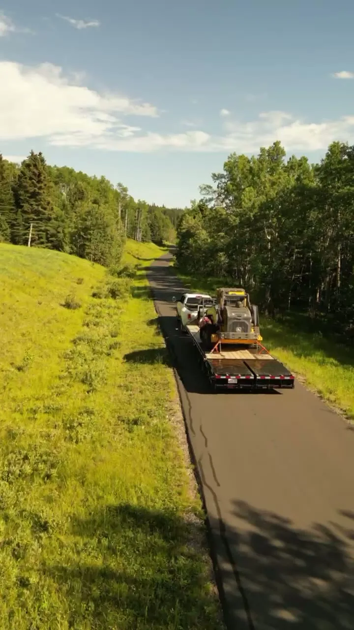
What gets shot in Hussar.
- agricultural
- industrial yard
- municipal infrastructure
Every subject above is delivered through the same aerial photography and cinematography services, scoped and quoted before the shoot is booked.
What the research actually says.
18 days to 4 hours
Marathon Pipe Line cut its response time to potential pipeline issues from eighteen days to four hours using drone inspection, preventing six major incidents in the first year at a reported saving of $8.3 million.
On linear infrastructure the cost is not the inspection. It is the time between a fault existing and anyone knowing about it.
Reported by Power Engineering, 2025
30% more
McKinsey research cited across the inspection sector finds that organisations relying on manual inspection spend materially more on maintenance and safety than those using drone-based assessment.
For a portfolio of assets, the inspection method is a recurring cost line, not a one-off purchase. The differential compounds annually.
Reported by McKinsey & Company, cited by Averroes, 2025
Advanced certificate
Transport Canada requires a Pilot Certificate for Advanced Operations to fly a remotely piloted aircraft in controlled airspace or near bystanders.
Most of Calgary sits inside the CYYC control zone. An operator without this certificate cannot legally fly the majority of addresses in the city.
Transport Canada, 2025
Hussar and what surrounds it.
- Aerial photography in Strathmore50 km · Class G uncontrolled
- Aerial photography in Standard29 km · Class G uncontrolled
- Aerial photography in Rosebud25 km · Class G uncontrolled
- Aerial photography in Kathyrn60 km · Class G uncontrolled
- Aerial photography in Keoma66 km · Class G uncontrolled
How a Hussar shoot runs.
- 01Scope and quote. Most Hussar work is agricultural or industrial yard, and the shot list follows the subject. Mobilisation is stated separately from the fee.
- 02Airspace. Checked against NAV Drone from the address, not the postcode. Hussar is class g uncontrolled, so authorisation is not normally required — but Beiseker aerodrome is 64 km away and its circuit is plotted regardless.
- 03Weather window. The eastern reach of the chinook belt. West wind arrives over open sections with nothing between the foothills and Hussar to slow it, so gust spread rather than average speed is the flight-planning number here. Harvest is the aerial calendar's peak — late-summer swathing and combining draw lines across the sections that exist at no other time of year. Snow simplifies the same fields to graphic black and white, and low golden-hour light does the most work in both seasons.
- 04Shoot day. About 85 minutes from the Calgary base. Launch from the subject property with the owner's permission; village and Wheatland County rules govern takeoff and landing on municipal land, so launches are staged from private property with the owner's permission as the default.
- 05Delivery. Edited files delivered digitally — no attendance required at any stage, which is how out-of-province owners of Hussar property are served.
Hussar questions, answered.
Does drone photography in Hussar require airspace authorisation?
Normally no. Hussar sits in uncontrolled Class G airspace, well outside the charted Calgary-area control zones and about 64 km from Beiseker aerodrome, the nearest listed aerodrome. No airspace authorisation is normally required, and the specific site and altitude are still confirmed against NAV Drone before every flight.
Is Hussar close enough to Calgary for a single-visit shoot?
Yes, but as a planned trip rather than a quick add-on — the drive is about 85 minutes each way. A Hussar booking pairs naturally with Standard, Rosebud or Strathmore on the same mobilisation, which spreads the travel across two or three shoots and keeps each one economical.
When is the best light for aerial work around Hussar?
The first and last hour of sun. The land around Hussar is level, so midday overhead light flattens it into a single tone. Low-angle light rakes across the fields, pulls texture out of crop and stubble, and gives the Hussar Grain Elevator a shadow long enough to anchor a frame.
Hussar is 50 km from Strathmore.
Mobilisation is quoted from the Calgary base, so a shoot in Hussar and one 50 km away in Strathmore are priced differently even when the subject is identical.
Nearby
Coverage
Airspace information last verified . Rules change — every flight is re-checked before it happens.